Custom Build · Private Platform

RT Density

A geospatial analytics platform that turns raw compaction data from sensors on the rollers into a live map of every pass on the site. We rebuilt the web portal, automated the data pipeline behind it, and built a mobile app so crews can see coverage from the field.

Web App Mobile App AI & Automation
Build Something Like This
RT Density

What We Built

RT Density measures soil and asphalt compaction on construction sites. IoT sensors mounted on the compactors stream position and density readings as the machines work, so instead of a handful of spot tests you get a reading everywhere a roller has been. We were brought in by their technical team to rebuild the customer portal that turns that firehose of data into something a project can actually use.

The hard part is the geospatial processing. We reworked the pipeline so the heavy lifting (ingesting sensor tracks, binning millions of points into hexagons, computing pass counts, coverage and percent-of-target-density by area) runs automatically rather than by hand. In the process we cut cloud-compute cost and brought data-visualization load times and the amount of data shown per view to a much better place.

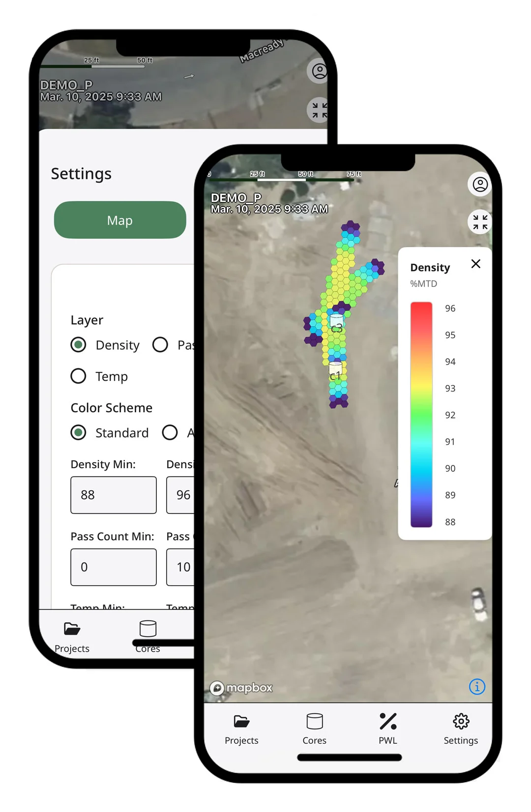
The map renders density, pass count and temperature as color-graded hexbin layers over a satellite view, with adjustable thresholds and core-sample locations. Then we built a companion mobile app so field crews can pull up the same picture on a phone while the rollers are still running.

Key Capabilities

Sensor ingestion

Position and density streamed from IoT sensors on the rollers as they compact.

Automated hexbin mapping

Millions of readings binned into a clean, color-graded coverage map with no manual step.

Pass count & coverage

Every pass of every roller tracked, so crews see what's compacted and what still needs work.

Density, temp & QA

Percent-of-target density and temperature computed by area for quality control.

Adjustable thresholds

Set density and pass-count targets; the map recolors to show where the site meets spec.

Mobile field app

The live map, layer controls and core data on a phone, for the crew running the rollers.

In the Field

RT Density mobile app: hexbin density map and layer controls
The mobile app: the color-graded hexbin density map over the site, with layer and threshold controls.
“

Customer Testimonial

Thanks to BDG, we saved resources and money on cloud computing and experienced notable improvements in data visualization loading times and the amount of data displayed on a single page. BDG's timeliness, responsiveness, adaptability, and understanding of our vision were exemplary.

Garrett

Have a system worth building?

Bring us the problem. We'll build the solution.